-40%
IMPORTANT HISTORIC WWII JULY 1944 MAP GERMANY AND ITS APPROACHES
$ 42.24
- Description
- Size Guide
Description
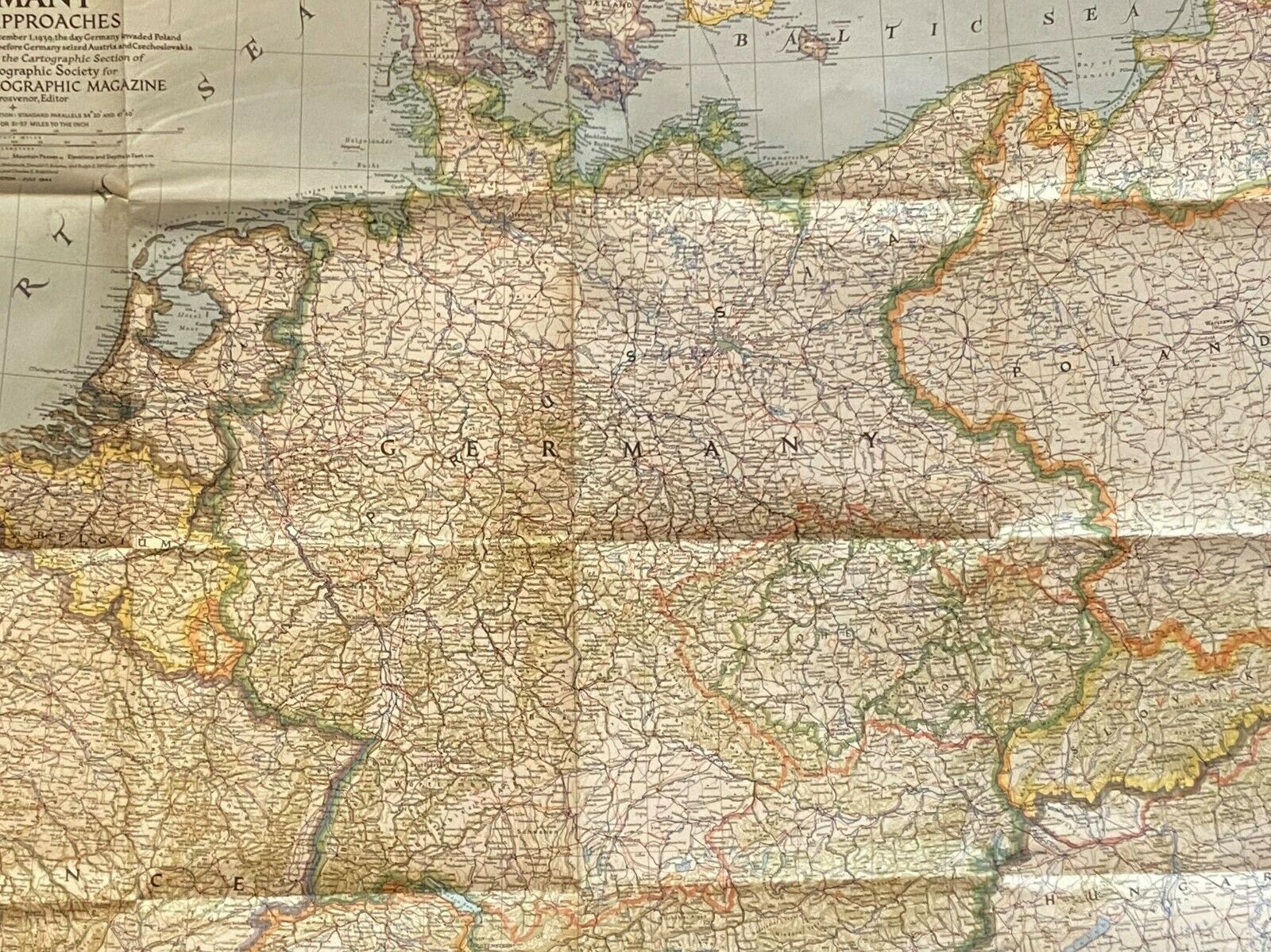
HISTORIC WWII 1944 MAP "GERMANY AND ITS APPROACHES", JULY 1944Several years ago I obtained at auction this fine WWII July 1944 dated map, "Germany And Its Approaches". It is a large map, 26"x33" which has fold lines but otherwise I would place the condition as Very Good. As the map highlight notes, the map denotes
"International boundaries as of September 1939 the day Germany invaded Poland and in Red, Boundaries as of January 1, 1938 before Germany seized Austria and Czechoslovakia."
Clearly the map symbolically indicates two factors at this time of the war against Nazi Germany: 1) the international boundaries of countries such as Poland before Germany invaded Germany in September, 1939; and 2) the recognized boundaries of Austria before Germany annexed Austria to become part of "Greater Germany", and when Germany boldly marched into Czechoslovakia without England or France taking any action. It was only when Germany invaded Poland that England and France drew the line; one country too far. I imagine this map indicates how victimized countries such as Poland and Czechoslovakia were to regain their international boundaries taken over by Nazi Germany before the outbreak of WWII.
Of added importance is the date this map was published: July, 1944 when the Allied troops were still trying to break out of the French coastline following the D-Day invasion in June. Therefore, the fate of the Allied forces and the Germans they faced was still far from decided.
30 day return guarantee as long as the map is returned in the same condition as sent. Mailing cost includes insurance and is based on domestic mailing; international mailing cost is based on destination and will be through Ebay's Global Shipping Program.
This map could be very impressively framed and would fit well in several types of collections: a general collection of WWII ephemera and a collection of historic maps, particularly WWII maps of Europe.

